Brisbane Valley Rail Trail Long Weekend Loop

ByVince Masci
Posted

BVRT Long Weekend Loop

→436km ↑3578 ~48% Gravel

Loathing the dreary weather of the Melbourne winter, partner Hannah and I decided that it might be an idea to abscond to warmer parts up north for The Kings Birthday long weekend. A long weekend that is in-fact not celebrated over the same weekend in Brisbane or Queensland.

 
The Brisbane Valley Rail Trail (BVRT) follows the disused Brisbane Valley Rail from Ipswich (approximately 40km west of Brisbane)  to Yarraman, an 161km adventure traversing farmland, forests and picturesque rural towns.
 
The loop we chose cycles right out of the Brisbane Airport following bike paths through the CBD and the western suburbs until you reach Ipswich and the trail head of The BVRT. We rode the full length of the BVRT until Yarraman before backtracking roughly 60km on the trail to Harlin and looping through to the towns of Kilcoy, Woodford & Caboolture whilst linking up The Wamuran to Caboolture Rail Trail and The Moreton Bay Cycleway back to Brisbane Airport.

You’ll find on this page, information and mapping on riding either just The Brisbane Valley Rail Trail or The Brisbane Valley Rail Trail Loop that we rode. 

Our intention for the long weekend was to ride something adventurous, safe and not too challenging in terms of technicality or logistics (ie. distance between towns).

The Brisbane Rail Trail certainly ticked those boxes. The trail is never too far from a town, something to eat, something to drink or somewhere to sleep making the whole planning process extremely easy. There’s minimal road crossings and very minimal road riding which makes the trail an extremely safe ride.

In terms of adventure and technicality, the trail offers enough to make you feel like you are off the beaten track and offers plenty of scenery to take in. Given it being a relatively flat trail, there’s not much in the way of sweeping views and much of the trail does run through farmland which at times can feel a bit desolate but does pair well with a sunrise or sunset.

95% of the trail is gravel and lots of maintenance is evident on keeping the trail rideable and safe although having said that, there are sections of the trail where the gravel can be a little looser at times and small sections with tight bends, slightly bevelled single track or steep gradients over the multiple ford crossings.

Did we enjoy ourselves? Yes we absolutely did. I’ve done more adventurous rides than this one and certainly more scenic, but it was the relaxed pace with which we were able to tackle this without the worry of traffic and all the while riding on a 161km network of gravel which made The Brisbane Rail Trail unique and a damn good time.

I would certainly recommend the Brisbane Valley Rail Trail for those seeking a relaxed adventure somewhere warm.

Logistically, travelling interstate with a bike can be challenging, more so, what to do with your travel gear once you have arrived interstate.

Should you bring your own bike or hire one at your destination?

We prefer to ride our own bikes and owning a bike bag each makes this significantly easier.
If you have no other luggage other than your carry on and your bike (in a bike bag or bike box) and the bag or box is under 23kgs, it will cost you nothing extra to fly domestically in Australia with Qantas or Virgin.
Should your bike plus bike bag be over 23kgs, it’ll cost $50 – $60 if you are flying Qantas or Virgin (not sure about the budget airlines).
*You will not be able to travel with luggage greater than 32kg in weight, so ensure that you are under.

Alternatively, you could hire a bike bag (try the Gumtree app), pack your bike into a cardboard bike box (generally freely availably at your local bike store) or hire a bike in Brisbane from Brisbane Valley Rail Trail Cycles. (They only hire our mountain bikes and it will logistically effect where you start on the BVRT, which wasn’t for us).

Once you arrive at your destination, what do you do with your bike luggage?

Some airports have lockers for luggage storage options available such as “Smarte Carte”, which you’ll find at Brisbane Airport. Just ensure that you check the dimension limitations and the availability of lockers on their website (link here).

We opted to stay at the Brisbane Airport on the night of arrival and the night prior to departure so that we could leave our bike luggage with the airport hotel. (Probably not the cheapest option but it is a simple option).

Can I get to the start of the trail (either north or south trailhead) without riding there?

Yes you most certainly can. There is a shuttle option for groups, couples or individuals called Out There Cycling who will shuttle you to and from any point on the trail or even the Brisbane Airport.
Failing that, there is an air train at the Brisbane Domestic Airport Terminal that can take you into Brisbane City (Bowen Hills) before you change lines and travel onto Wulkuraka Train Station (Right near the southern trailhead, just passed Ipswich).

Was it tricky riding out of the airport?
We were fairly apprehensive about this but the roads proved to be quiet, fairly easy to navigate and safe enough to ride. I wouldn’t suggest leaving at peak traffic times however.
.

Best places to eat, sleep or camp?
The Brisbane Valley Rail Trail website is a fantastic resource for all this information. 
Outside of the rail trail, Kilcoy & Woodford are excellent places to stay, generally with plenty of food, accomodation and camping options available.


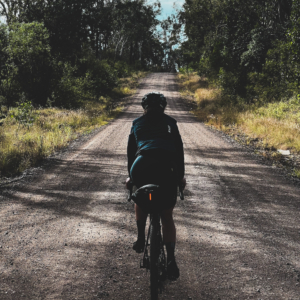
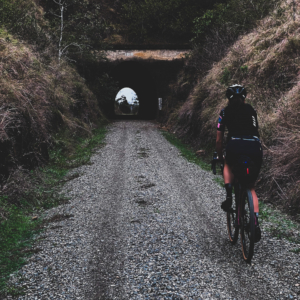
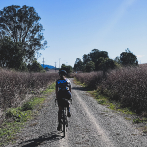
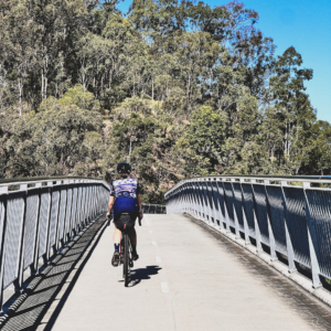
The Brisbane Valley Rail Trail Route

→162.7km ↑1464 ~89% Gravel

Riding South to North is definitely the harder direction to travel given that you will accumulate roughly an extra 400m in ascent with that extra elevation coming mainly between Blackbutt and Yarraman. 

For the BVRT north to south route, click here.

.
.
*Best viewed in HD.
0:00 Brisbane Airport to Brisbane Valley Rail Trail Trailhead (Ipswich)
5:00 Brisbane Valley Rail Trail Trailhead to Yarraman
18:00 Harlin to Brisbane Airport


Brisbane Airport to BVRT Trailhead

→67km ↑679m ~0% Gravel

Mainly bike paths and bike lanes leading you from Brisbane Airport to the trailhead of The BVRT. You’ll find yourself riding on the road at times but it’s a fairly safe and straight forward link up.
.

Particularly enjoyed the cycleway through Brisbane. 


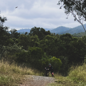
Yarraman to Brisbane Airport (Our loop with improvements)

→220km ↑1572m ~31% Gravel

This involves quite a bit of backtracking on the BVRT but it’s quite nice to ride from the opposite direction, especially considering it’s a nice and long descent into Blackbutt and beyond.
.

The route has a brief stint on The Brisbane Valley Highway from the small town of Harlin which is quite busy but has a shoulder to ride on. Alternatively, you can take the BVRT down further and climb a small embankment onto the highway which is significantly closer to the turn off on Gregors Creek Rd. Both sections are marked on the map.
.
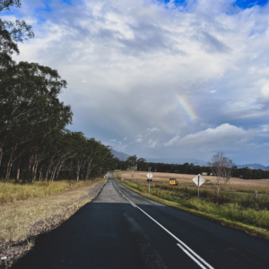
Gregors Creek Rd and Neurum Rd are both 100km speed limit, paved roads that hold low to average amounts of traffic depending on the time of day. We felt safe riding them.
.

The Wamuran to Caboolture rail trail is a really nice smooth ride albeit short.
.
From there, I’ve tried to cut out some of the busier sections that we rode in favour of quieter streets and more time spent on the Morton Bay Cycleway which is really beautiful by the bay. This means a few more km’s but a much safer journey. 


BVRT Alternative Loop (not ridden)

→407.6km ↑4557m ~45% Gravel

I stumbled upon this alternative loop after we completed our loop. It looks a little better in that you cover more road rather than back tracking and it offers a different approach into Brisbane which looks to be a bit more out the way of busy roads.
.
Bear in mind that we did not ride this and can’t vouch for the roads but I will give it a stab in the near future.
.
This alternative route starts and finishes in Brisbane city but it shouldn’t be too difficult to link back up with the airport using our other maps of the route.


Leave a Reply

Your email address will not be published. Required fields are marked *

Other Blogs You May Like

Repulse Dam over The Derwent
The Tasmanian Trail is a long distance, multi-use trail originally designed for hikers and horse riders although it...
IMG_8117 copy
The Northern Groadies are a fully inclusive social cycling group that meet once a month over a weekend...
6f8977a4-2193-4a42-b1c4-fd96e7b26296
This is a simple resource to help you get routes from the web onto your device, whichever you...
Search Ride